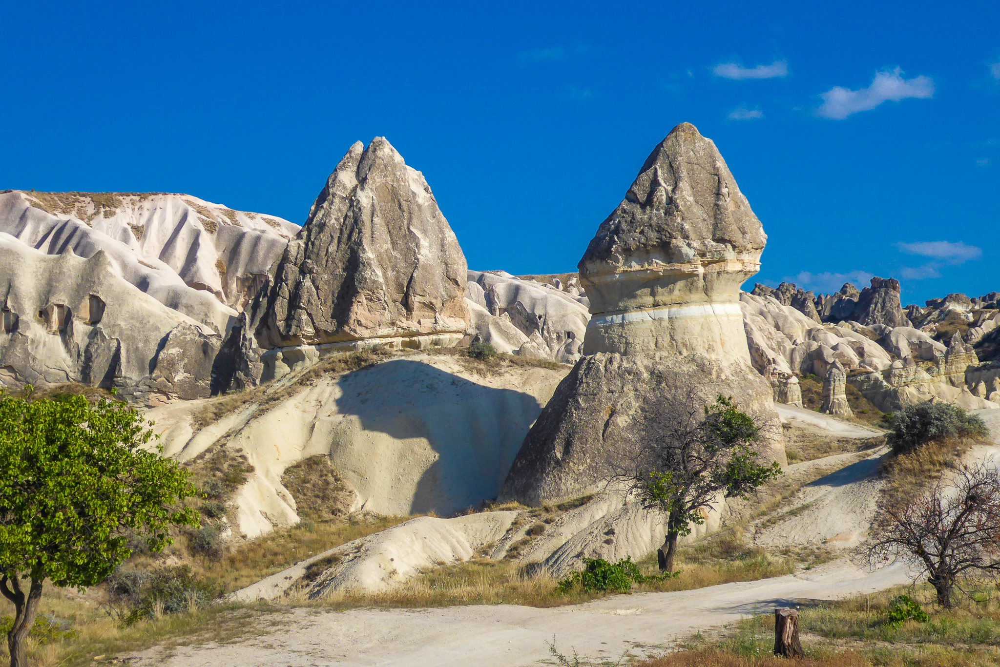
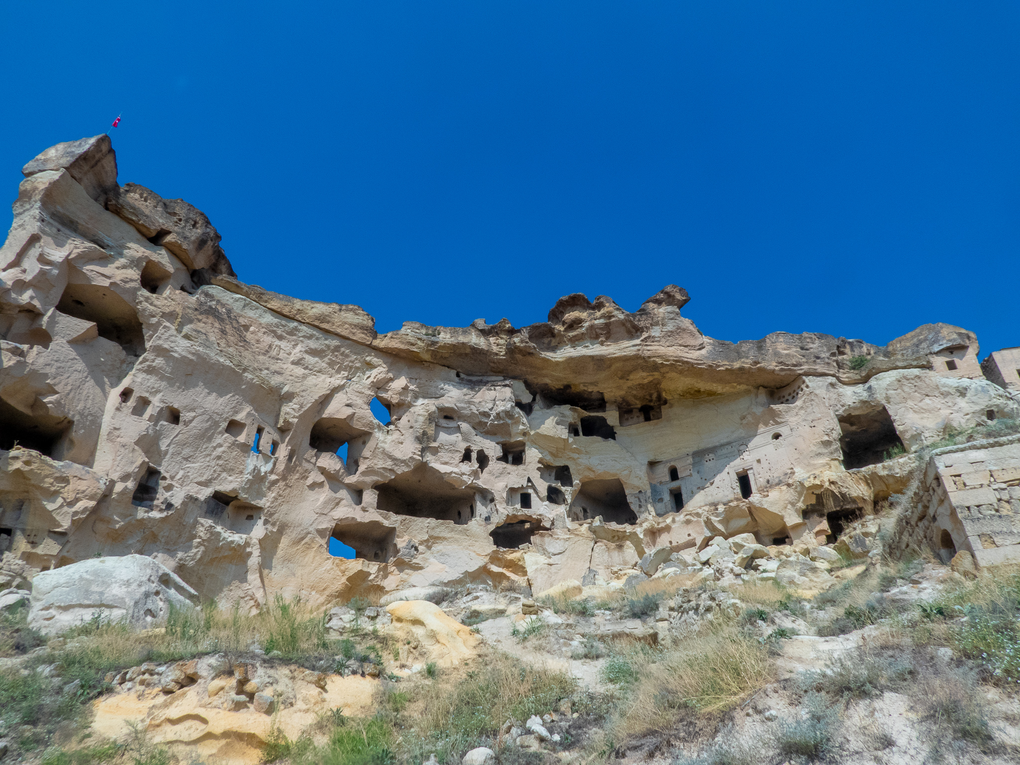
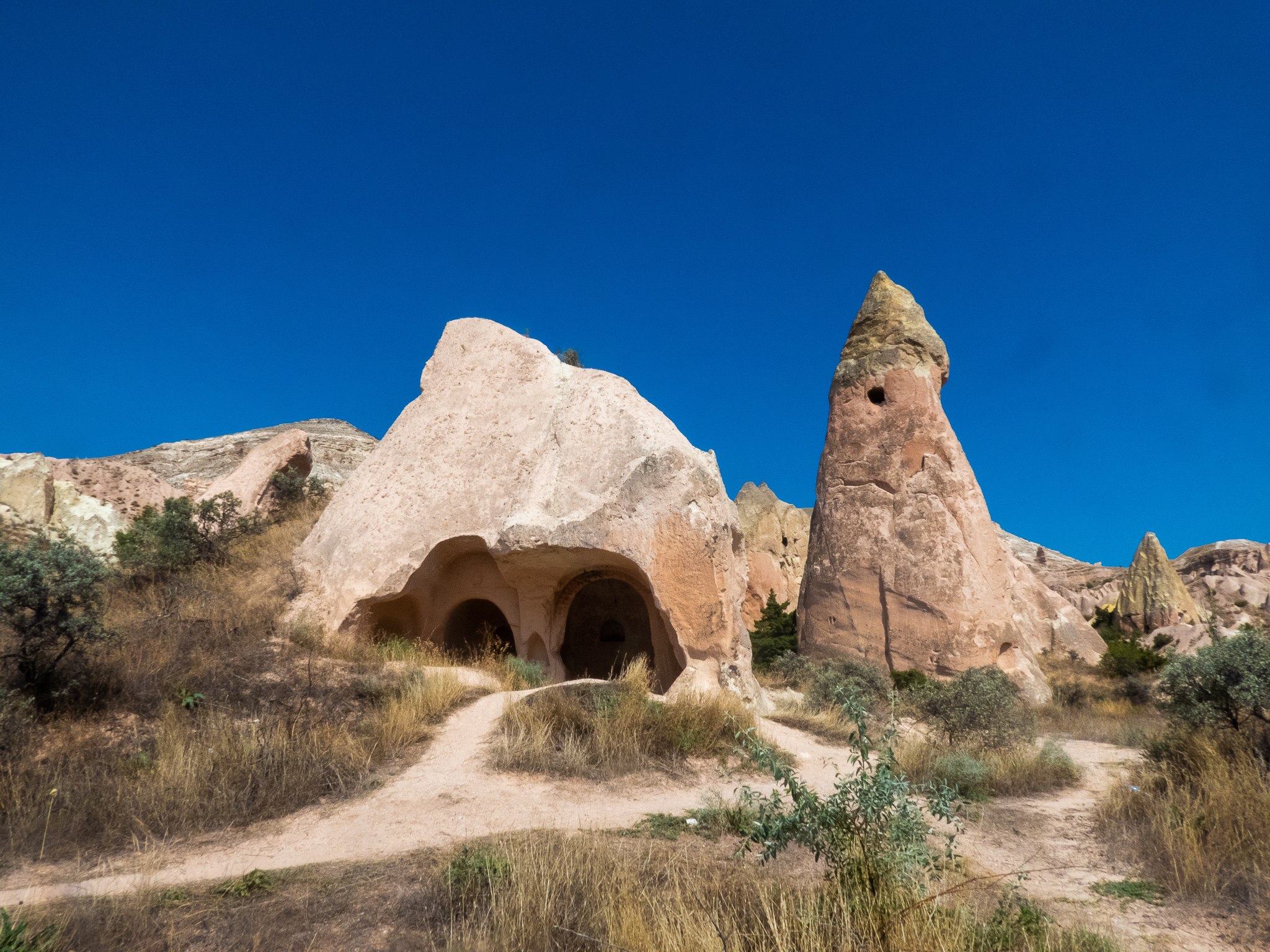
For most people the highlight of any trip to Goreme will be a ride in a hot air balloon that provides spectacular views of the moon-like landscape from above. However, as good as this might be, it doesn’t provide you with an opportunity to see up close and personal 4th century AD rock-hewn churches and multitudes of magnificient fairy chimneys, hoodoos, cave cells and rock formations. To do that, you need to scope out the many valleys that surround Cappadocia’s most famous town on foot.
We spent six days in Goreme and I was fortunate enough to be able to go out running on each of these in order to fully explore most of the trails around Goreme. In nearly all instances I was just about the only person on them, with the exception of a couple of trails where tourists are shipped in on buses at the start of the trail so they can get a photo before heading back to the souvenir shops or do whatever else it is that they do with the rest of their day.
The first thing you need to do is get a map of the region, which should be available from your hotel. However, even the map is only of limited use, as when you actually get out on the trails there are loads of paths criss crossing each other which makes navigation difficult. Add in confusing marker signs and you’re almost guaranteed to get lost. As I did pretty much every day.
But that’s half the fun, so long as you have plenty of sunscreen and water and some sort of GPS device so that you don’t get yourself into serious trouble. The usuals apply in order to keep safe out there as well, such as informing someone where you’re going and being mindful of when the sun sets to avoid having to spend an overnight out on the trails, which you definitely do not want to do. During normal day time hours, my advice is to plan on spending at least twice as much time out there as you think you will, just in case. Which, given the beauty of the place isn’t necessarily a bad thing, so long as you’re prepared!
Another thing worth noting is that the trail signs are in Turkish, so it’s best knowing their Turkish name to at least give yourself a chance of not getting lost. Not helping matters is that there is plenty of information on the Net which also gets the names wrong and Google Maps aint much help either. If you’re thinking I’m prepping you for getting lost at some point, you’re probably right. Of course, you could avoid all this and hire yourself a guide, but where’s the fun in that?
Below is a list of what I think are the best trails in the region.
1. Rose Valley (Güllüdere Vadisi)
Rose Valley is probably the most “popular” trail, in as much as it is usually touted as being the best trail in the region and with good reason. Reasonably easy to access from the town of Goreme, it provides the best mix of lunar landscapes, fairy chimneys and rock-hewn churches without the accompanying crowds.
As well as superb vistas, Rose Valley has a number of rock-cut churches and cave monasteries worth checking out.
One of the best churches in the area is the Direkli Kilise or Columned Church, which has six columns inside. This used to be reasonably inaccessible, but a bridge makes this much more accessible than it used to be.
If you continue travelling down Rose Valley you’ll eventually end up in the town of Çavuşin. The town used to be an old Greek Village and now competes with Goreme as a quieter hub for tourists. The main touristic feature of the town is the 5th century AD Saint John Monastic complex which dominates all around it. It’s a bit of a scramble to the top with no safety barriers and completely open to roam freely which provides some great views from the top.
If you continued on from Cavusin, you’d end up at the extremely popular Monks Valley and thence onwards towards Zelve Open Air Museum, albeit a reasonabl distance away.
2. Red Valley (Kizilçukur Vadisi)
To be honest, I’m not sure if anyone knows where Rose Valley stops and Red Valley starts. I’m still confused to this day as to when I was out running on one versus the other. Needless to say, if you’re out at Rose Valley, you’re more than likely to also stumble upon Red Valley at some point and it’s probably easiest to consider the two trails as extensions of one another even if they do loop around in different directions.
One of the best things you’ll see while out on Red Valley is Haçlı Kilise or Cross Church which has painted frescoes which you are able to pictures of from the inside (with no flash, of course!).
Regardless of what the trails you end up on are called, the main thing is to just get out there and start exploring.
3. Honey Valley (Bağlıdere Vadisi)
More commonly known as Love Valley (you’ll see why soon), this is my second favourite trail after the Rose/Red Valley combo. Forming part of the larger White Valley (Akvadi Vadisi), this is another great place to see lunar landscapes and in my opinion the best place to see fairy chimneys.
Of course, once you’ve seen the fairy chimney out here, the valley’s name will not be lost on you.
The valley begins just north of Uchisar and runs for about five kilometres. If you’re wanting to access from Goreme, you can walk/run along Pigeon Valley before crossing the Goreme/Uchisar Road and hooking up with Love Valley (although, in fairness it isn’t that easy to find). When Love Valley finishes you can then turn right onto the road and make your way to Cavusin or cross the Goreme/Cavusin Road and you’ll find yourself on Rose Valley. From here you can loop back to Goreme or continue exploring Rose and Red Valley, depending oo how big a day you’ve planned.
4. Zemi Valley (Zemi Vadisi)
Zemi Valley was the first trail I got out on and probably the closest thing I’d equate to the trail running that I’m used to. There are plenty of caves, fruit orchards, rock formations and a modicum of fairy chimneys and churches to check out. I hadn’t planned on running very far, so didn’t bring my running vest which stores my “running camera” and therefore didn’t take any photos. However, the trail itself was great running across varied terrain and for a big part of it reasonably shaded.
The start of the trail is on Muze Caddesi, which is the road from Goreme out to the Goreme Open Air Museum. From here it’s about 6.5 kilometres one way until you reach the Nevsehir/Ugrup Road, at which point its time to turn around and run back the way you’ve come. En route is El Nazar Kilisesi which has the cool translated name of Church of the Evil Eye. Unlike the frescoed churches in the Goreme Open Museum, there are next to no crowds here which makes it a much more pleasant experience. However, remember to bring 10 TL, as there is an entry fee charged.
5. Pigeon Valley (Guvercinlik Vadisi)
Pigeon Valley is another one worth taking the time to explore, especially if you want to head towards Uchisar to see the Citadel. Named for the small pigeon dwellings that are carved into the rock faces, the valley provides a good mix of scenery from the backdoor step of Goreme. There are also some churches here that are worth looking at. As mentioned previously you can add Pigeon Valley onto Love Valley or you run a chunk of Pigeon Valley before heading east across to as well as the nearby Görkündere Valley, Iceri Dere Valley or Zemi Valley. Again, this was a trail I ran without a camera, so unfortunately no photos.
6. Monks Valley (Paşabağ Vadisi)
When strolling or doing research on Goreme you’ll often hear/read of Fairy Chimney Valley. This is the valley that is supposed to be most synonymouns with the fairy chimnety formations with hats that makes Goreme famous. The valley itself, which also goes by the name of Paşabağ Rahipler Vadisi or Pasabagi Valley, is about five kilometres from Goreme and is one of the most frequented stopoffs on tours. WIthin Monks Valley there is a three-headed fairy chimney chapel which is dedicated to Saint Simeon who lived within it, in solitude for fifteen years. While the chimneys are impressive, in my opinion, they aren’t nearly as good as those in Love Valley.
7. Imaginary Valley (Devrent Vadisi)
Most popularly known as Devrent Valley, this valley goes by a number of other names such as Imaginary Valley, Pink Valley and Dervent Valley. It seems that there is as many names for this valley as the number of people that visit it to view the many animal shaped rocks here. This probably would be a great valley to visit with kids as it accessible directly from the road and you can plan loads of games in trying to make out the various animal shapes which are supposed to include a snake, seal, dolphin and camel.
The main drawback to exploring Imagination Valley is that there really is a ton of people here all doing the same thing.
8. Back of Beyond Valley
OK, that’s not actually the real name of the trail but it was a trail I ended up on while trying to find a route from Red Valley to Monks Valley. For the most part it consists of open trails that bake you in summer and I imagine will be snow covered but gorgeous in winter,
While there’s not that much to see along the route for the effort that’s required, there are a couple of places of interest along the way. These include the ruins of Halil Dede Türbesi (no information other than what I found on Google Maps) and a beautiful vista (below), after which there’s a very steep descent down to the Ugru Road and onto Devrent Valley.
So, there it is. Six days of glorious trail running where the only thing that came up behind me was this guy down below.


